|
ISLE OF MAN - SEPTEMBER 2001 |
In September 2001, I had the opportunity to fly with the Manx Flyers
Aero Club, who are based at Ronaldsway airport, in the Isle of Man. For those of you
who don't know, the Isle of Man is an island that's 30 miles long by about 15 wide
in the Irish sea, between England and Ireland. It's a pretty unique place - it's
not part of the UK, but is a British territory. It has its own government, three
railways and a mountain. It's where the Manx Cat is from (those cats who genetically
don't have tails). As any avid motorcyclist knows, it's the home to the Manx TT,
which is THE motorcycle race of the year.
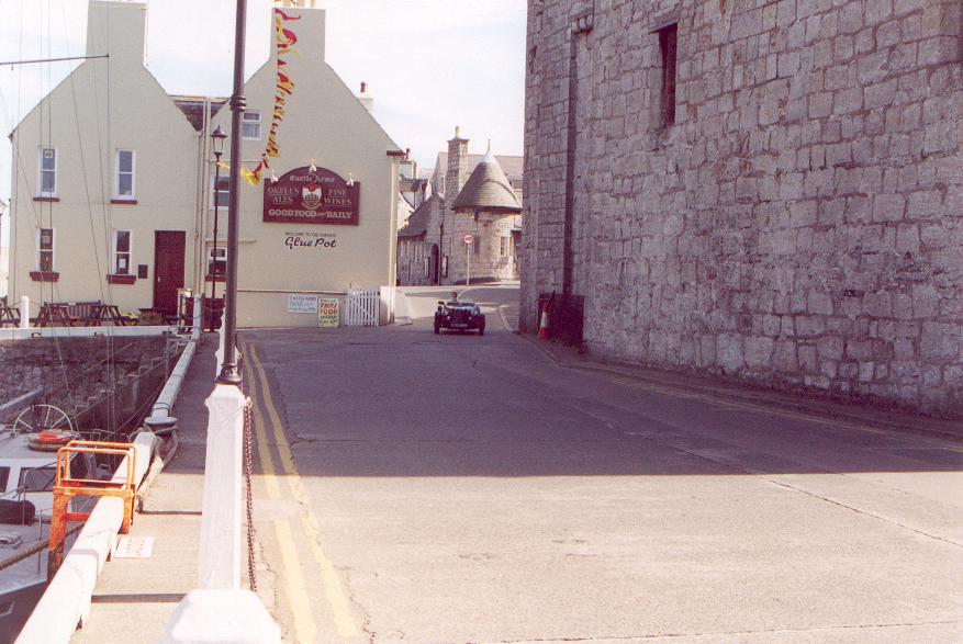
My Dad lives in Castletown, in the south of the island, not far from
Ronaldsway. Whilst I was back over from Texas, I thought it'd be great to be able
to take him flying. The Isle of Man follows the UK regs for aviation (and the aircraft
are G-registered - see my flying in the UK section for what
a US-certificated private pilot will experience. In summary, a private pilot
with a foreign certificate can fly day VFR in a G-registered plane with absolutely
no paperwork to be filled out). Ronaldsway Airport is reasonably sized; probably
about the same size and traffic level as an airport in the United States with
class C airspace. The controllers there are very GA friendly - I think three of them
are members of Manx Flyers.
Manx Flyers have a couple of Cessna 172s (as well as a helicopter, and
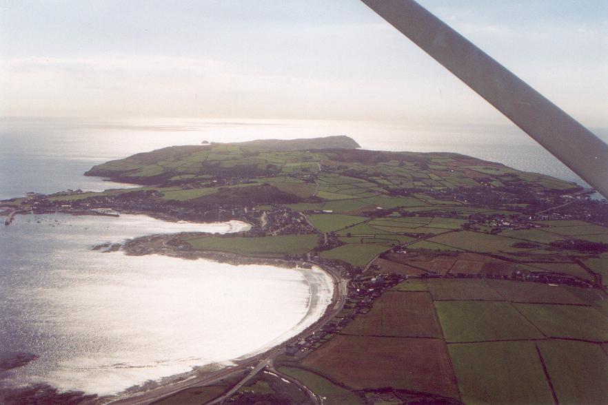
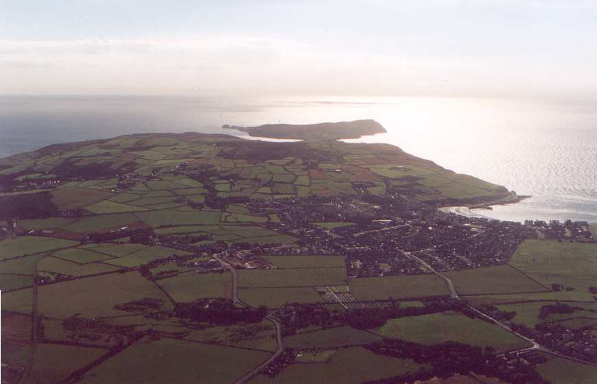
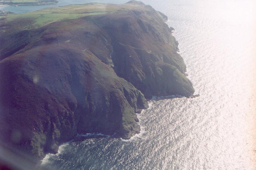
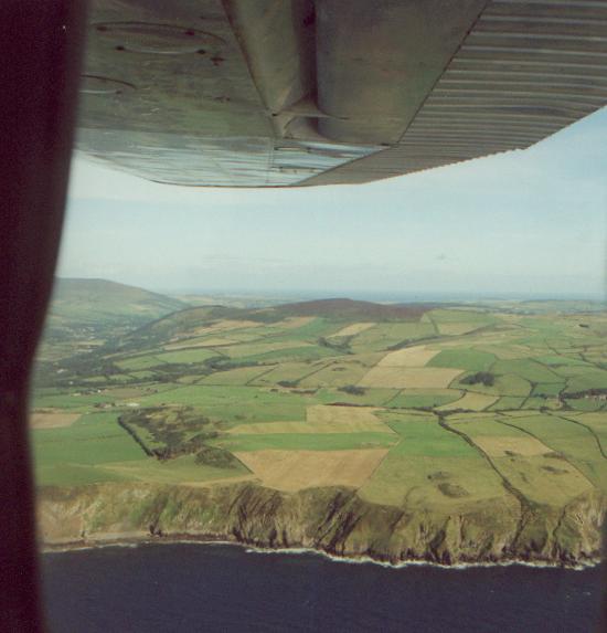
probably by now, a twin). You can circumnavigate the Isle of Man in about 40 minutes
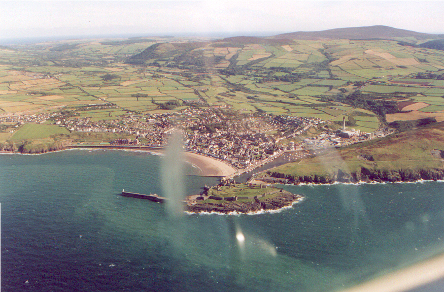
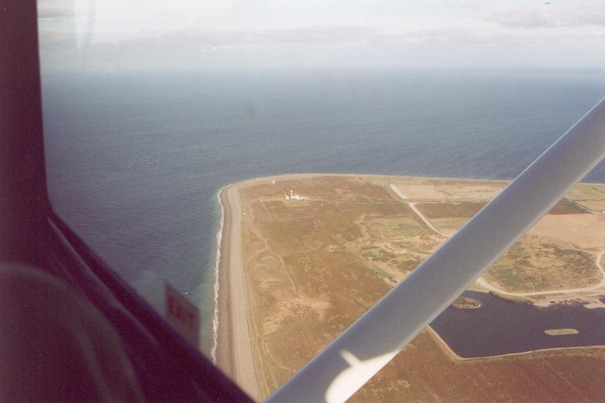
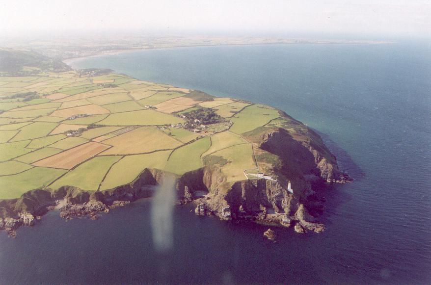
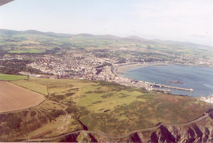
of flight time, and as the photos below will show, it's a beautiful and unique place
to fly.
My checkout at Manx Flyers consisted of three touch and goes, and a quick
tour of the immediate area of Ronaldsway. The airport is big with three long paved
runways. The radio work is not much different to flying out of a field with
class C airspace in the United States, and my checkout dealt with the differences.
It took about ten minutes to get used to it. The biggest difference was that there
is no clearance delivery or ground control frequency - for clearance delivery, you
"book out" by calling ATC on the phone from the clubhouse, giving very similar
details as you would when calling clearance delivery. You then fire up and call the
tower when you're ready to taxi, and they'll give you the usual instructions.
A couple of phrases are different - you'll hear "line up" instead of "position and
hold", and you'll hear "pass your message" instead of "go ahead". Once you're off,
you'll be handed off to departure. If you tour the island, there are reporting
points you can use when you call approach to come back in.
I flew a C172H with the tail number G-CCCC (that's a lot of Charlies),
which fortunately gets shortened to Golf Charlie Charlie once you've made initial
contact! My Dad took photographs as we flew. After our flight, we retired to the
clubhouse which is right by the sea, and which has a pub. You can sit outside in
the autumn sunshine, pint in hand, and watch the BAe-146s come and go! Talk about
being in heaven!
Manx Flyers have a website - go to
http://www.manx.flyer.co.uk and take a look around. They have photographs of
the planes, the airport and the clubhouse there. All their contact details are
available should you wish to fly with them.
If you are into Flight Simulator, there is some good Isle of Man scenery at
Magrathea (along with other British
Isles scenery).
Click on the thumbnails for a standalone fullsize image. The photos are in clockwise
order around the island.